Conchos River Basin
Water
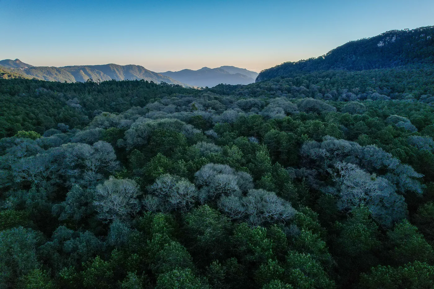
Chihuahua, México
In the semiarid landscapes of Chihuahua, scrub and grassland are key ecosystems. However, pressure from communities has reduced their capacity to sustain wildlife and people. For this reason, we work hand in hand with ejido communities in ecological restoration actions. Our goal is to improve water infiltration, stabilize soil and recover native vegetation. With this, we ensure the long-term resilience of the ecosystem and of those who depend on it.
150
K
cubic meters
of volumetric water benefits
486
hectares
positively impacted by nature-based solutions
234.5
kilometres
of soil conservation works

(01)
The context
A Living Soil with Water for the Future
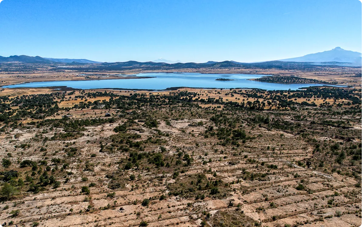
In the Conchos River basin, overexploitation of aquifers, deforestation and unsustainable production practices have drastically reduced the availability of water. This situation causes scarcity of resources for human consumption and agricultural activities, aggravated by the loss of fertile soil and the reduction of water infiltration into water tables. As a result, rural communities face increasing challenges in maintaining their livelihoods, while ecosystem health continues to deteriorate.
The environmental impact is equally critical: the loss of native vegetation and accelerated soil erosion have altered natural cycles, diminished biodiversity and affected the resilience of the area to climate change. Without restoration and sustainable management actions, the region risks moving towards an irreversible process of desertification, compromising both the well-being of the population and the long-term ecological balance.
Location
Chihuahua, México
Dimensions
The intervention covers 486 priority hectares for SBn intervention within the Conchos river basin, which constitutes the entity's main water source and has an area of approximately 71,402 km².
Productive Activities
Agriculture in the Francisco I. Madero ejido is a fundamental economic activity that faces challenges related to water availability and irrigation infrastructure. Ejidatarios in the region cultivate a variety of agricultural products, including corn (for human consumption, fodder for cattle and, in some cases, local sale) and alfalfa (mainly used to feed local cattle). Livestock farming is another important economic activity in the development of the ejido.
Vegetation
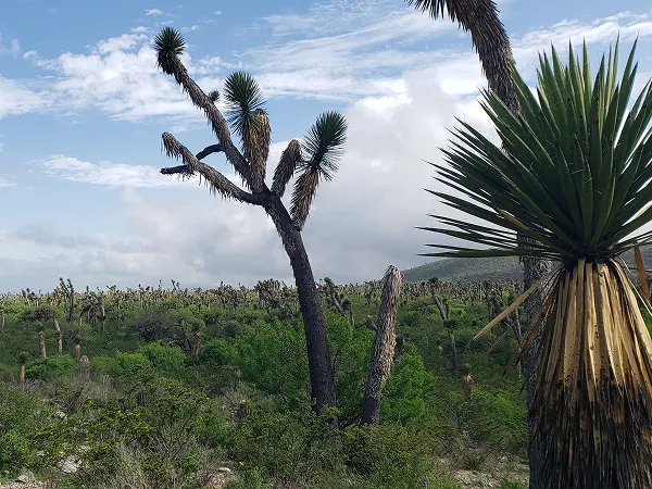
Xerophilous scrub
Fauna
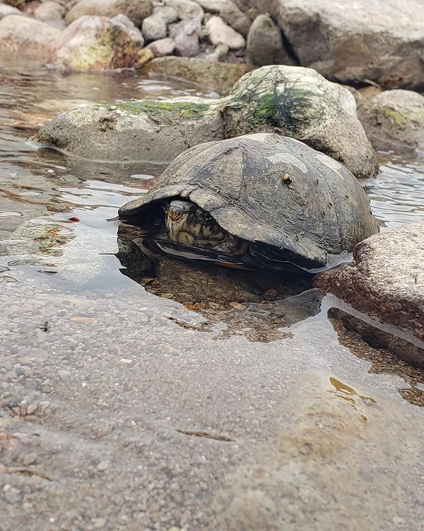
Mammals such as desert rabbits (Sylvilagus audubonii) California Hare or Antelope (California lepus, alleni lepus), Fast Fox (vulpes velox), Coyote (Canis Latrans), Mexican gray wolf (Canis lupus baileyi, reintroduced), wild cat (Lynx Rufus), puma (Puma with color), rodents adapted to the desert such as cactus mice (Peromyscus eremicus), Kangaroo Rat (Dipodomys spp.) and ground squirrel (Ammospermophilus interpres), a variety of night bats and, on occasion, jaguar records (Panthera (ounce); Birds Like Roadrunners (Geococcyx californianus), golden eagle (Aquila chrysaetos), Peregrine Falcon (Falco peregrinus) and Kestrel (Falco sparverius); reptiles and amphibians such as some rattlesnakes, collared lizards, toads and desert turtles.
Flora
Trees such as Oaks (Quercus sp.), touch yourself (Juniperus sp.), mesquite (Prosopis spp.) and huizache (Acacia spp.); cacti such as biznagas, candelillas (Euphorbia antisyphilitica), nopales (Opuntia spp.) and cardones; pastures such as Bouteloua gracilis And Bouteloua eriopoda And Plants Like Cat's Claw (Mimosa distachya) and governor (Larrea tridentata).
Certifier
Protocol
Verifier
(02)
The activities
On-the-Ground Action
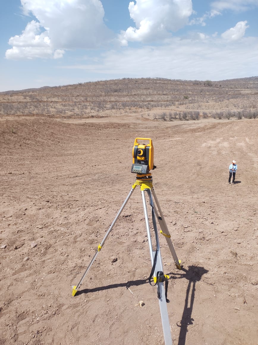
Environmental Analysis and Management
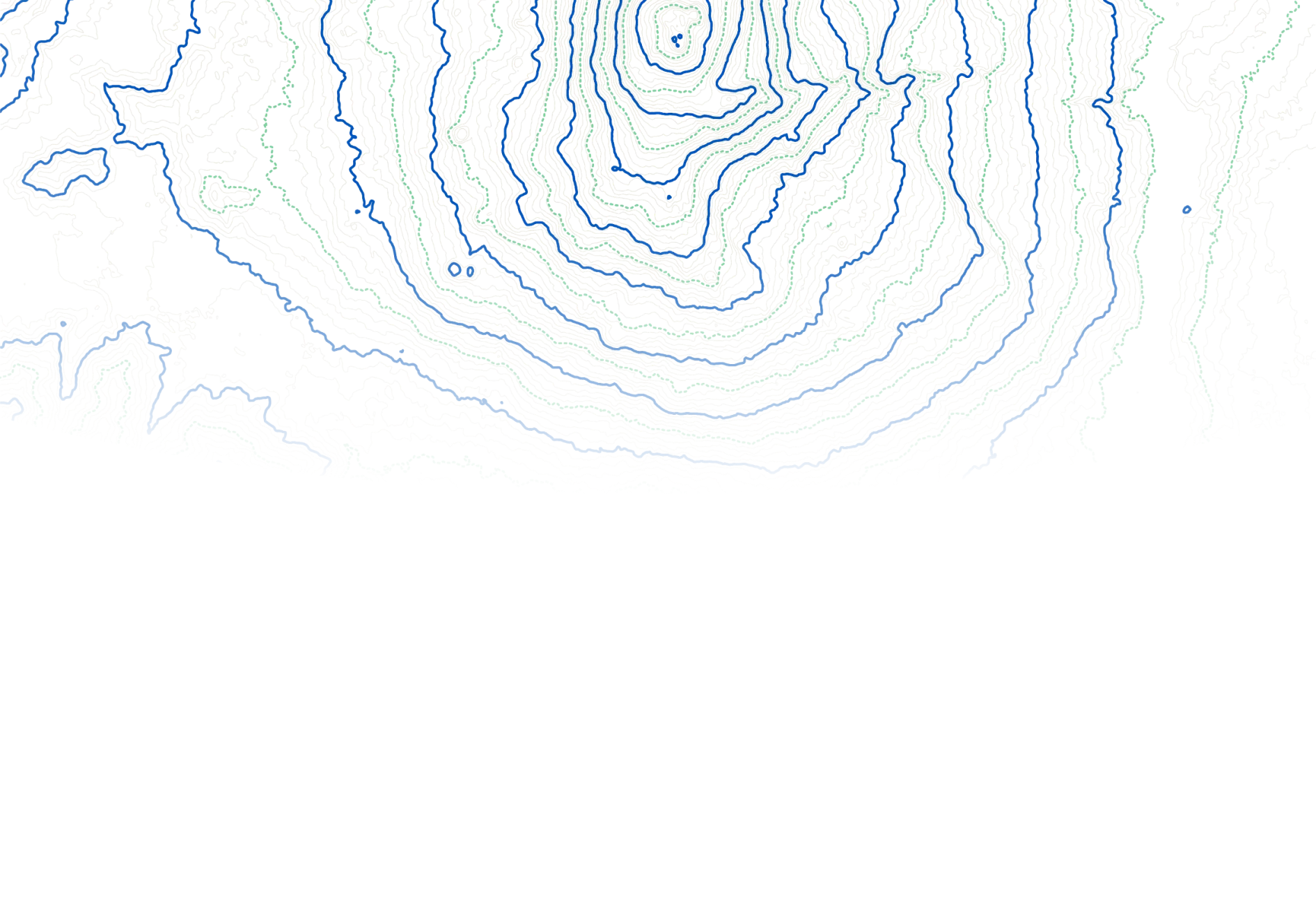
The territory was analyzed with GIS, soil samples and hydrological models to define priority areas for intervention.

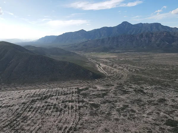
Identifying Priority Areas
More than 304,000 ha were studied using GIS and multi-criteria evaluation (slope, clays, water network, land use). High priority areas were defined for intervention.
Planning Restoration Efforts
An uncalibrated baseline was built with 45 years of climate and soil data. The model showed low infiltration (6%) and high evapotranspiration (80%), which guides restoration actions.
Hydrological Model
Hydrological model with SWAT to evaluate the reduction of runoff and estimate volumetric water benefits in arid areas of Chihuahua.
Scenario Modeling with SWAT
The SWAT hydrological model was used with topographic and climatic data to estimate the reduction of runoff in areas with SBn. It simulated scenarios with and without intervention, yielding detailed results on hydrological behavior.
Water Retention Results
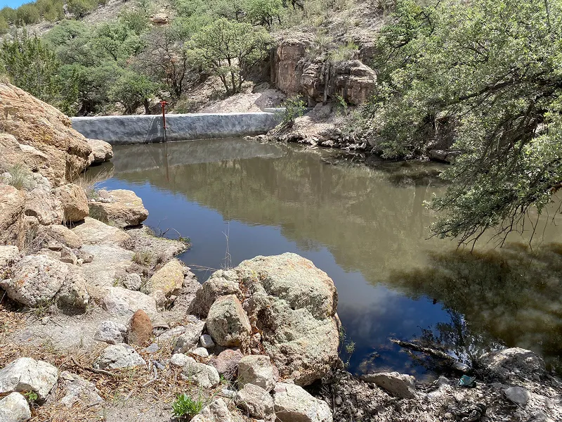
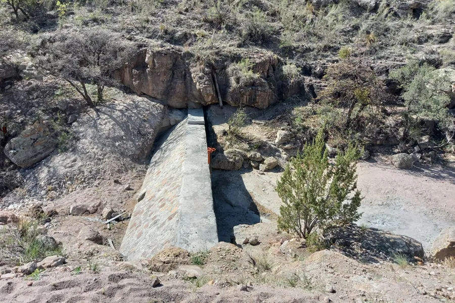
The SWAT model supported Volumetric Water Benefit Accounting. SBn was applied to 486 ha and retention works were built with 150 mL/year of capacity, promoting hydrological restoration and sustainable water management in Chihuahua.
NbS
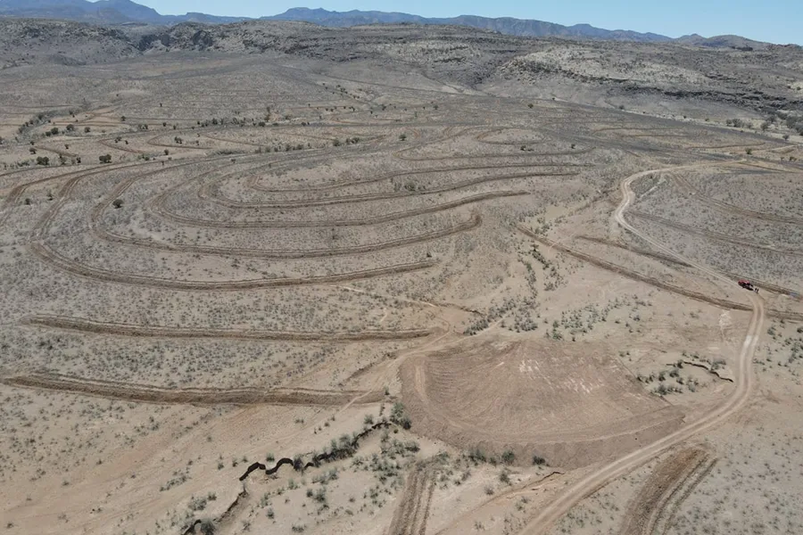
Soil and water conservation works on 486 hectares to reduce runoff, improve infiltration and stabilize soil.

Key Actions Implemented
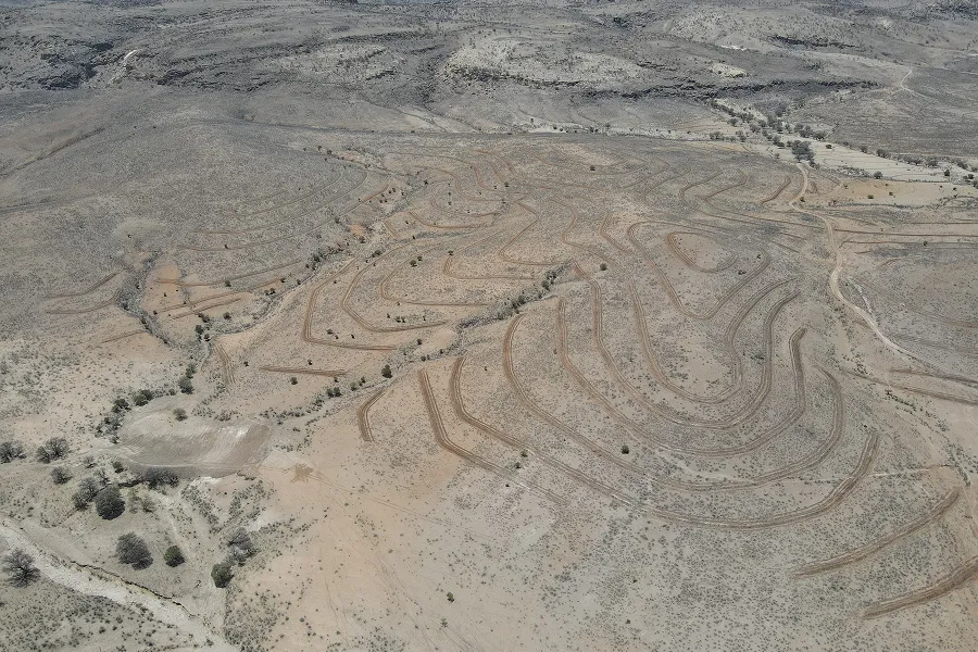
486 hectares were intervened through soil and water conservation works. The actions included bulldozer boards (76.426 m), ripper work (158.086 m), masonry dams (95.14 m³), accommodated stone dams (8.35 m³), gully headboards (179.6 m²) and pressures, with a total catchment area of 51,603.70 m².
The Impact of NbS
These works are designed to reduce surface runoff, improve infiltration and stabilize soil, thus strengthening the health of the hydrological landscape and the resilience of the region's arid ecosystems.
Workshops and Training
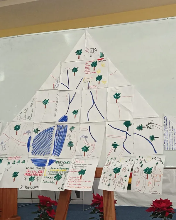
Thematic and community training focused on governance, land management and local participation.
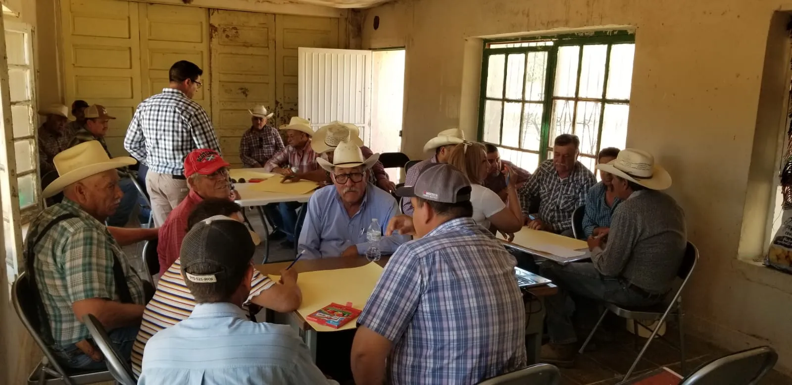
Workshops Delivered
Thematic workshops were held, including sessions on Regenerative Livestock, sustainable soil management practices and environmental education. These trainings sought to strengthen the technical knowledge of communities.
Impact and Engagement
The active participation of the community in the construction and maintenance of the implemented works was promoted, promoting territorial governance and ensuring the long-term sustainability of the project.


(03)
The Turning Point

NbS in Harmony with the Landscape
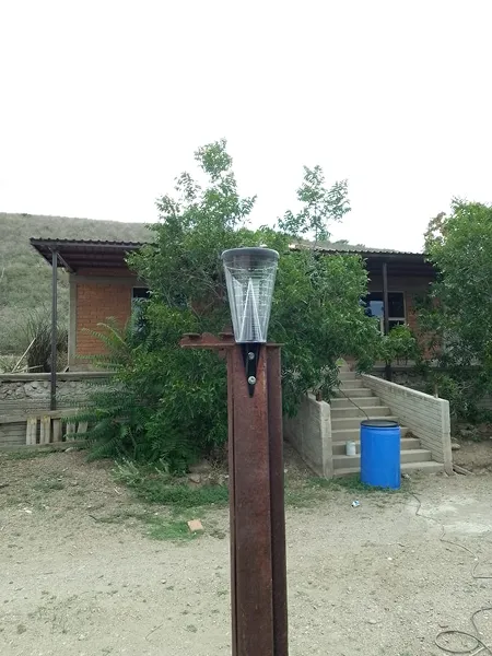
We carry out a series of soil and water conservation works that mimic natural processes and whose main objective is soil retention, reducing surface runoff and encouraging water infiltration. These actions are carried out in the upper and middle parts of the hills and hills to mitigate the progression of their degradation.

Governance Leads the Way
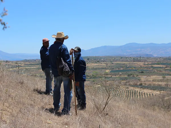
In ejido and community territories, local governance is the starting point. Communities not only authorize, but they lead the direction of the project: they identify priorities, participate in the design of interventions and guide their implementation. This approach ensures that actions respond to the real context and strengthen long-term ownership of the process.

A Portfolio with a Territorial Approach
Our portfolio ranges from tailor-made projects for companies that seek to compensate for the water they use in specific territories, to collaborative interventions that can be co-financed by different actors through our platform of projects ready to implement.
(04)
The Impact
Conservation with co-benefits

Stewarding the Land for the Future
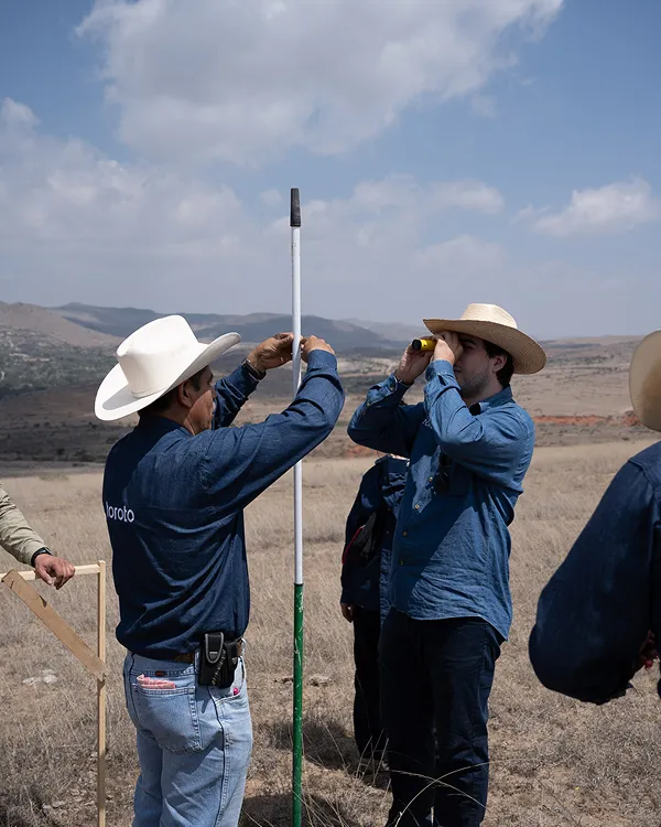
We conduct regular evaluations to strengthen ecological restoration efforts from the start of the project. This includes ensuring the survival of reforestation areas, effective maintenance of soil conservation works, preventive pest and fire control and, when applicable, monitoring the performance of productive projects.

Biodiversity Follows Water
Biodiversity doesn't just enrich the ecosystem: it gives it structure, supports the soil and allows water to infiltrate. Restoring native vegetation through reforestation and assisted regeneration improves habitat quality, stabilizes the landscape and creates shelters for key species.
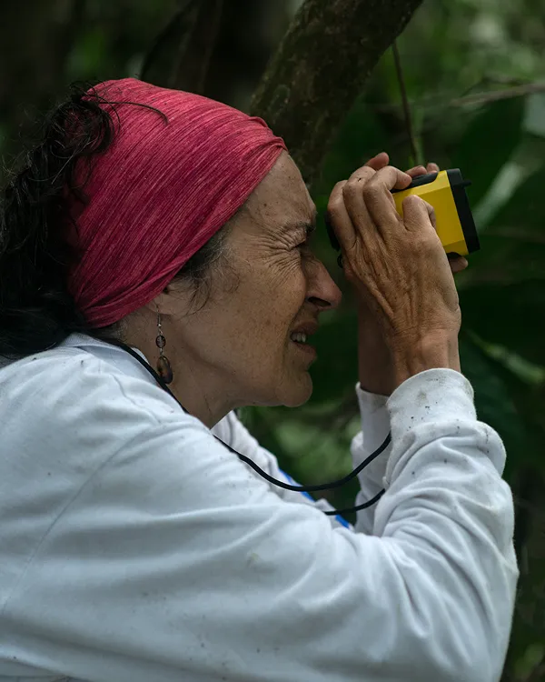
Through active monitoring — such as field trips and camera traps in strategic areas — we evaluate the presence of wildlife and identify areas of ecological connectivity. Thus, we ensure that the restoration not only captures water and carbon, but also recovers the functionality of the ecosystem.
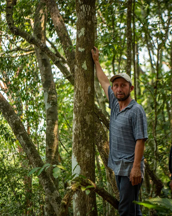
Building Local Capacities
The workshops and training are focused on providing new knowledge to promote a better relationship with nature and to be able to publicize the importance of the actions carried out in each of the Toroto projects. We show how to carry out fieldwork following an internationally recognized methodology. In addition, there are trainings aimed at ensuring the safety of brigade members and workers.
(04)
The Impact
Conservation with co-benefits
.jpg)
Stewarding the Land for the Future
We conduct regular evaluations to strengthen ecological restoration efforts from the start of the project. This includes ensuring the survival of reforestation areas, effective maintenance of soil conservation works, preventive pest and fire control and, when applicable, monitoring the performance of productive projects.
Biodiversity Follows Water
Biodiversity doesn't just enrich the ecosystem: it gives it structure, supports the soil and allows water to infiltrate. Restoring native vegetation through reforestation and assisted regeneration improves habitat quality, stabilizes the landscape and creates shelters for key species.
Through active monitoring — such as field trips and camera traps in strategic areas — we evaluate the presence of wildlife and identify areas of ecological connectivity. Thus, we ensure that the restoration not only captures water and carbon, but also recovers the functionality of the ecosystem.
Building Local Capacities
The workshops and training are focused on providing new knowledge to promote a better relationship with nature and to be able to publicize the importance of the actions carried out in each of the Toroto projects. We show how to carry out fieldwork following an internationally recognized methodology. In addition, there are trainings aimed at ensuring the safety of brigade members and workers.
Regenerating nature, one project at a time
We do important things differently.