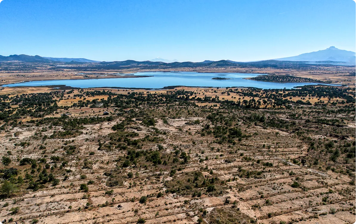
Valle de Banderas Aquifer
Water
Nayarit, México
In Nayarit's biodiverse landscapes, forests have historically been the guardians of water. As urban growth and tourism activity advance, it is crucial to restore and conserve these ecosystems to prevent the loss of water resources. With this project, together with local communities, we promote solutions that stabilize soils, retain moisture and ensure the long-term health of the basin.
115
K
cubic meters
of volumetric water benefits
180
hectares
positively impacted by nature-based solutions
50
K
specimens
reforested
5
ejidos and communities
involved

(01)
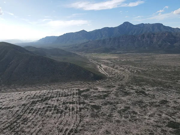
The context
Water Sustained by Deep Roots
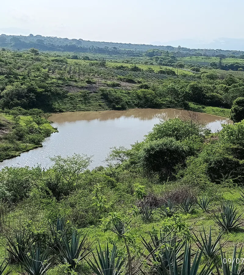
Lands that used to function as natural sponges, holding rain and feeding rivers and aquifers, are now being displaced by subdivisions, hotels and shopping malls. The loss of vegetation exposes soil to erosion and reduces its capacity to capture and conserve water. In the north, this situation aggravates water scarcity, limiting access to drinking water and affecting the health and way of life of communities that depend on these resources.
Faced with this scenario, the community has come together to restore vegetation cover, build terraces and filtering dams that favor the infiltration and retention of water. These actions seek not only to protect the ecosystem, but also to strengthen social and cultural resilience, ensuring that water remains the heart of the territory for present and future generations.
Location
Nayarit, México
Dimensions
The aquifer covers a total area of 118.842.83 hectares. The intervention is located in the El Colomo, El Coatante, Los Sauces, Cerro Pelón and Felipe Carrillo Puerto ejidos, with works on 180 hectares.
Productive Activities
The most representative activities are livestock, agriculture and tourism. In some cases ecotourism, and on an even smaller scale, beekeeping.
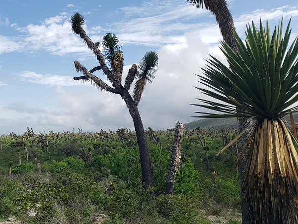
Vegetation
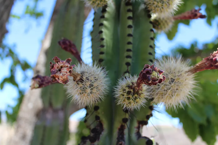
The predominant ecosystem in the aquifer area corresponds to tropical subdeciduous forests, although pine-oak forests can be found in some highlands.
Fauna
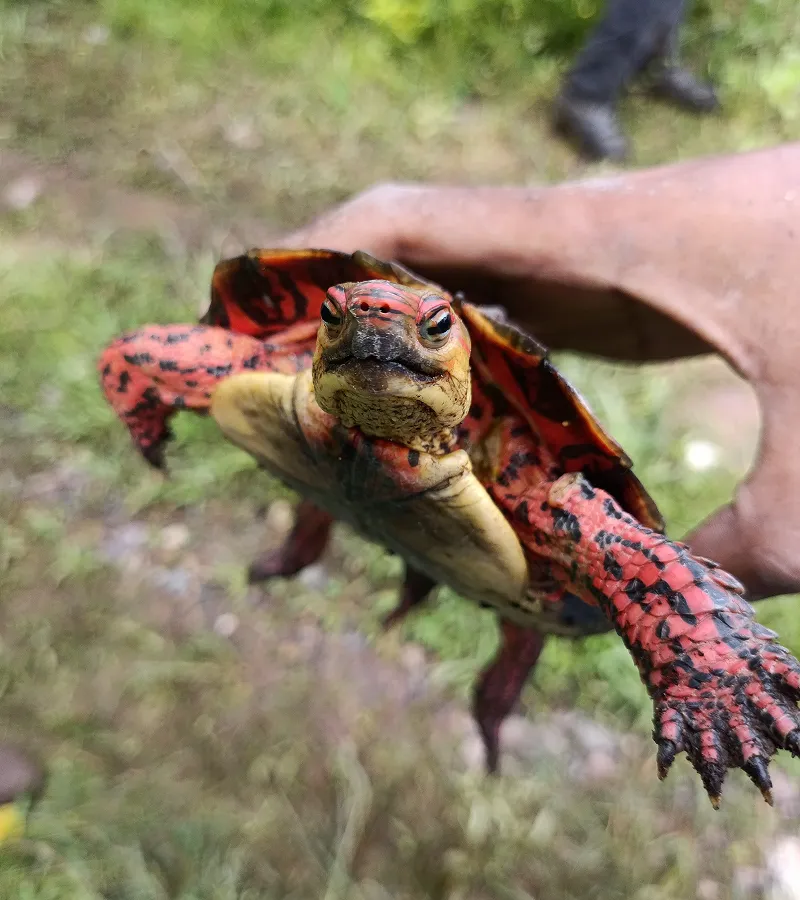
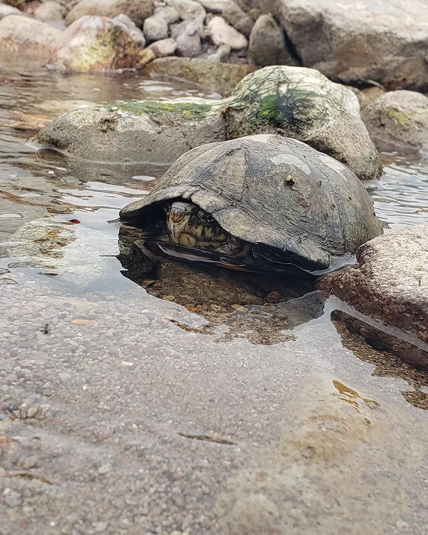
Mammals such as jaguar (Panthera onca), ocelot (Leopardus pardalis), Tigrillo (Leopardus wiedii), white-tailed deer (Odocoileus virginianus) and Talacuache Mouse (Tlacuatzin canescens). Birds such as green macaws (Ara militaris) and Lesser Black Eagle (Buteogallus anthracinus). Reptiles such as green iguana (Iguana iguana) and Pacific Rattlesnake (Crotalus basiliscus).
Flora
Representative species of the region includes capomo (Brosimum alicastrum), parota or guanacastle (Enterolobium cyclocarpum), Tepemezquite (Lysiloma divaricata), I speak (Hura polyandra), language (Leucaena leucocephala), chamomile (Swietenia humilis), the map (Tabebuia rosea), paper (Bursera simaruba) and Guamúchil (Pithecellobium dulce).
Certifier
Protocol
Verifier
(02)
The activities
On-the-Ground Action
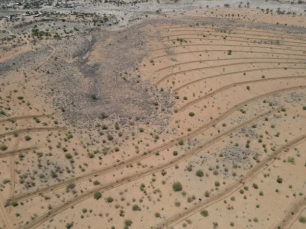
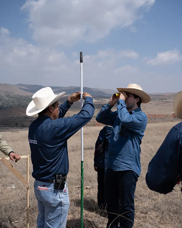
Environmental Analysis and Monitoring
More than 32,000 hectares within the Ameca-Ixtapa basin were prioritized using GIS and multi-criteria evaluation, to determine key areas of intervention considering erosion, slope and runoff.
Identifying Priority Areas
28,906 hectares were identified with potential for intervention; 66.76% with moderate priority and 33.16% with high priority. 96 samples were taken at 48 points to characterize the soil and strengthen the hydrological model.
Planning Restoration Efforts
For 2023—2025, 180 hectares were planned to be intervened: 89.3 ha in 2024 and 90.7 ha in 2025, considering soil texture, density and organic carbon as key variables for restoration.
Restoration and Conservation
The SWAT model was built with data from Daymet/INIFAP and soil studies, analyzing a monomodal rainfall regime and a marked water deficit from February to May.
40-Year Baseline
An average annual rainfall of 1,198.1 mm was determined. 27.37% corresponds to surface runoff and 18.86% to infiltration. A water deficit was identified in almost half of the precipitated volume.
Assessments for Sustainable Water Management
The model makes it possible to establish a key hydrological baseline for the design and implementation of solutions based on nature and water management in the region.
NbS
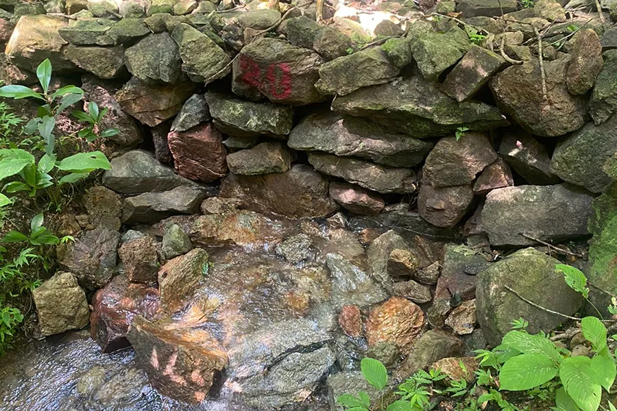
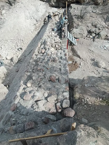
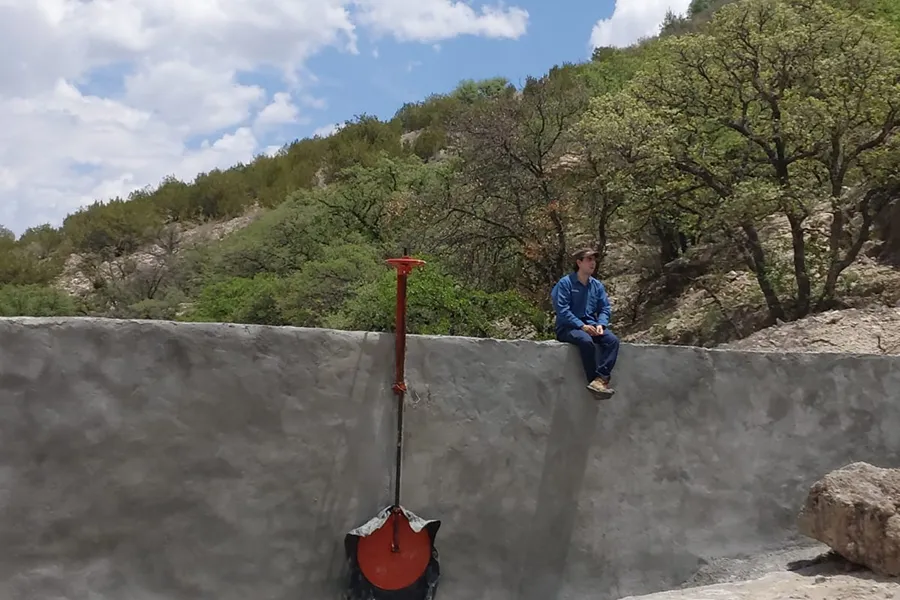
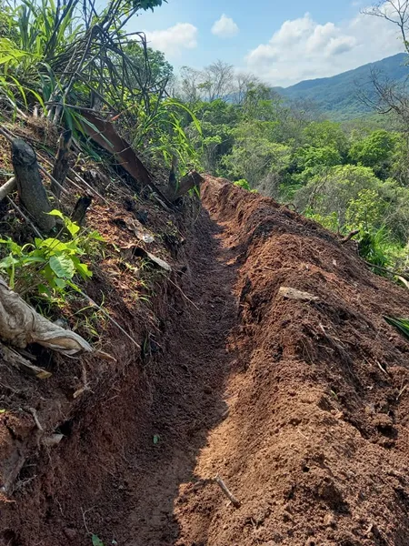
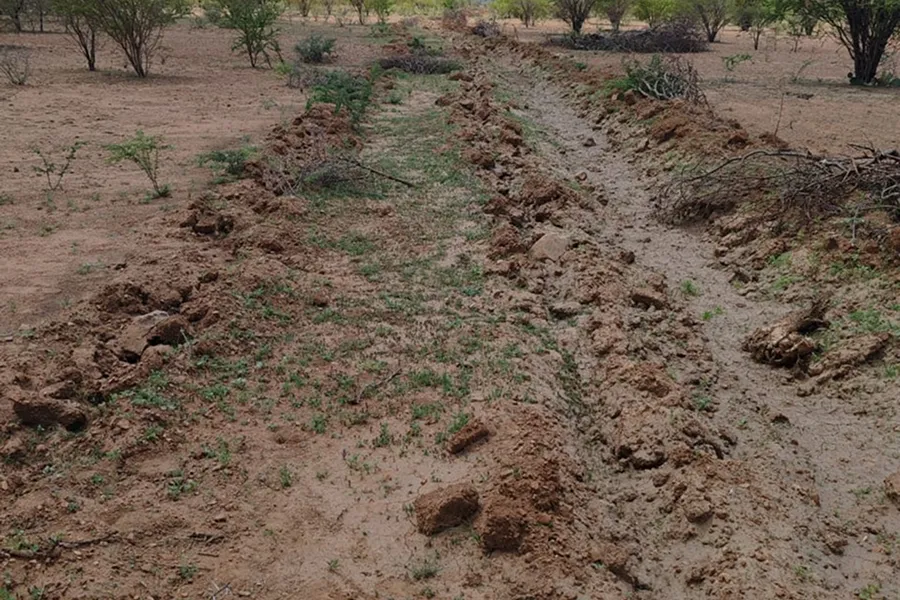
180 hectares were intervened with solutions to improve infiltration and reduce erosion, including terraces, dams, barriers and perimeter fences.
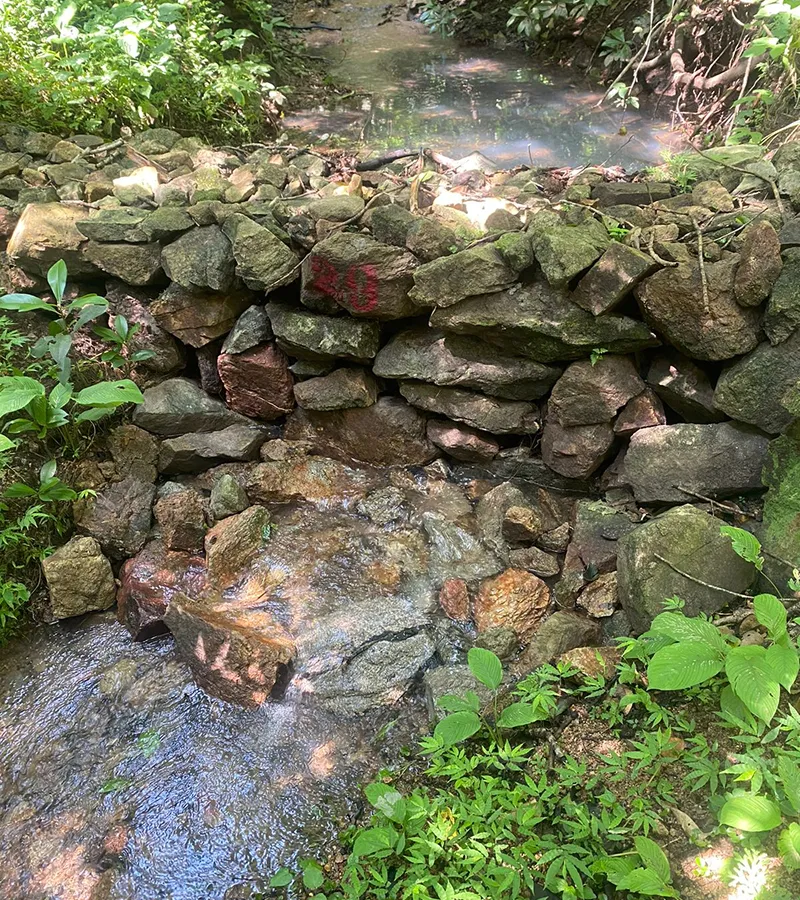
Erosion Control Infrastructure
Narrow terraces with living walls, stone dams (31 structures with 200 m³ in 2024), stone barriers, 4,199 m of living fences and 1,079 km of perimeter fences were built.
Reforestation with Native Species
Species such as Enterolobium cyclocarpum, Leucaena leucocephala, Gliricidia sepium and Brosimum alicastrum. In 2024, 23 ha were reforested and it is expected to reach 70 ha in 2025.
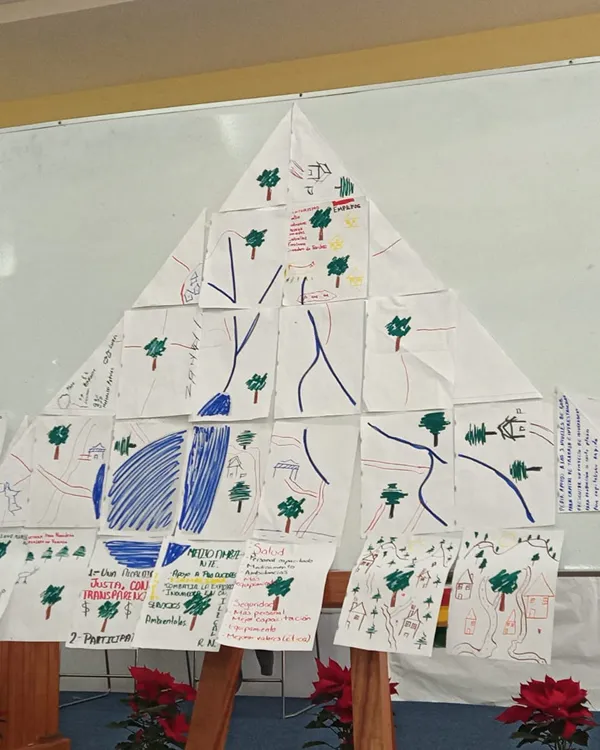
Workshops and Training
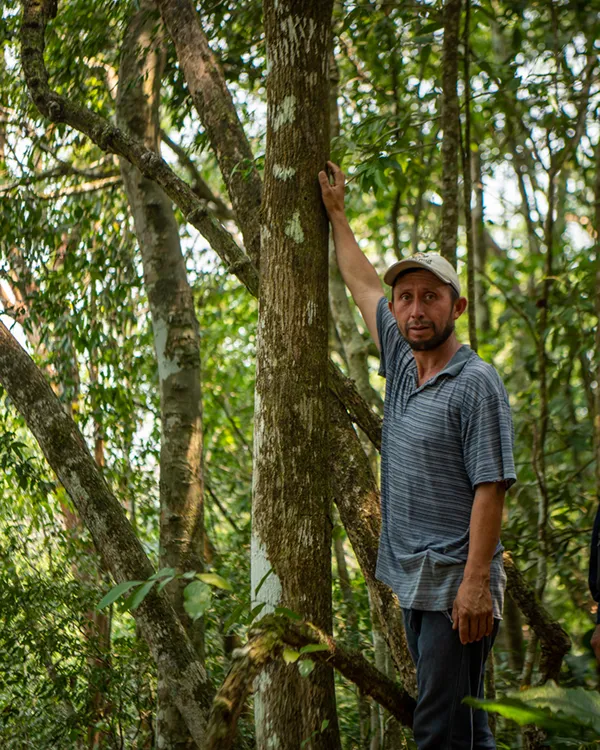
The community participation strategy includes hiring and practical training for soil and water conservation works, and ecological restoration techniques.
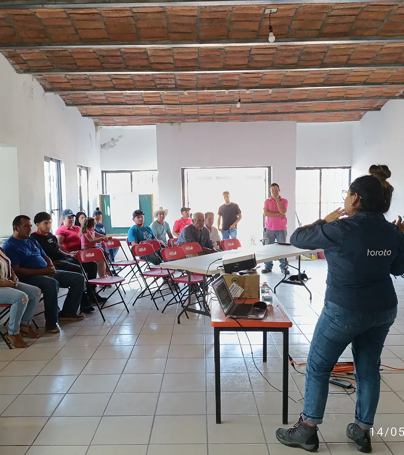
Building Skills in Restoration and NbS
Landowners are trained in regenerative livestock, SBN techniques, reforestation and first aid, integrating productive and environmental actions.
Engagement and Project Expansion
Meetings are organized to present the benefits and requirements of SBNs, generating collaboration agreements, expansion of areas and new community commitments.

.jpg)


(03)
The Turning Point

NbS in Harmony with the Landscape
We carry out a series of soil and water conservation works that mimic natural processes and whose main objective is soil retention, reducing surface runoff and encouraging water infiltration. These actions are carried out in the upper and middle parts of the hills and hills to mitigate the progression of their degradation.

Governance Leads the Way
In ejido and community territories, local governance is the starting point. Communities not only authorize, but they lead the direction of the project: they identify priorities, participate in the design of interventions and guide their implementation. This approach ensures that actions respond to the real context and strengthen long-term ownership of the process.

A Portfolio with a Territorial Approach
Our portfolio ranges from tailor-made projects for companies that seek to compensate for the water they use in specific territories, to collaborative interventions that can be co-financed by different actors through our platform of projects ready to implement.
(04)
The Impact
Conservation with co-benefits

Stewarding the Land for the Future
We conduct regular evaluations to strengthen ecological restoration efforts from the start of the project. This includes ensuring the survival of reforestation areas, effective maintenance of soil conservation works, preventive pest and fire control and, when applicable, monitoring the performance of productive projects.

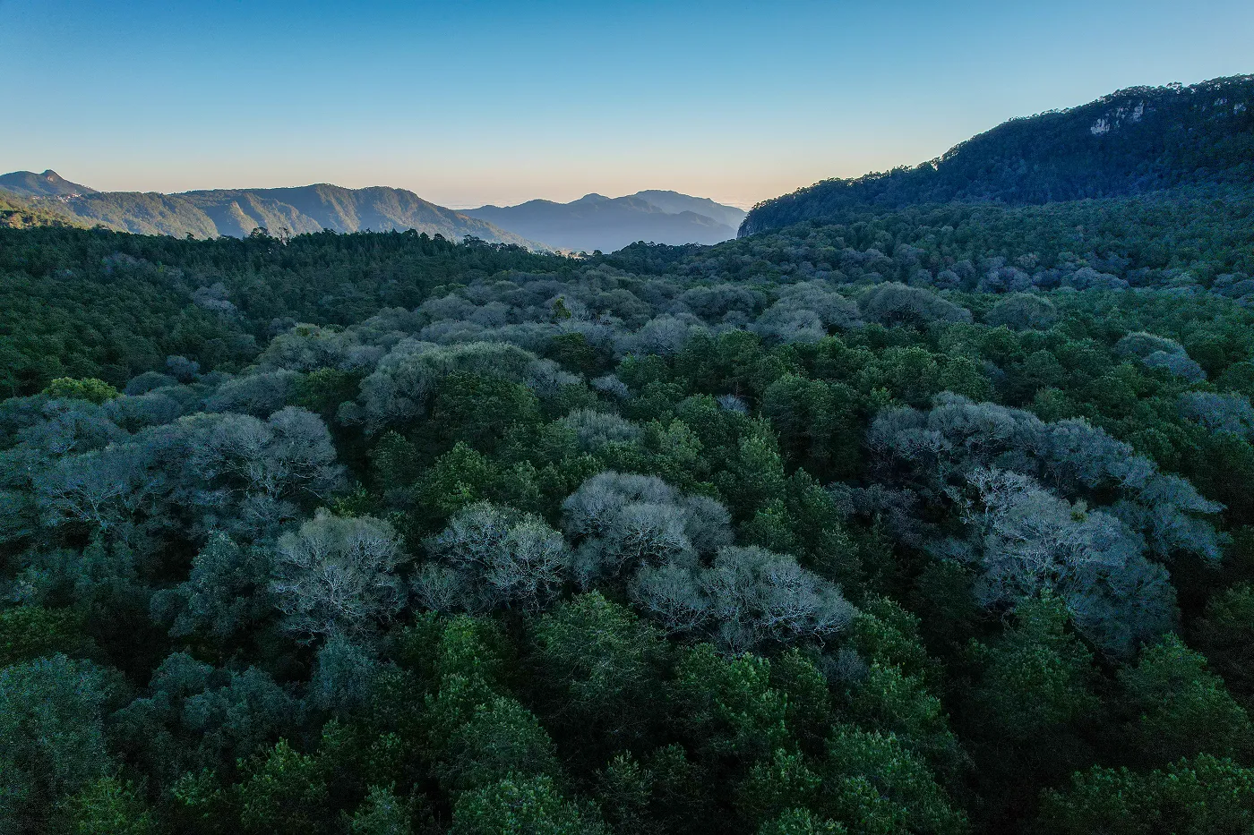
Biodiversity Follows Water
Biodiversity doesn't just enrich the ecosystem: it gives it structure, supports the soil and allows water to infiltrate. Restoring native vegetation through reforestation and assisted regeneration improves habitat quality, stabilizes the landscape and creates shelters for key species.
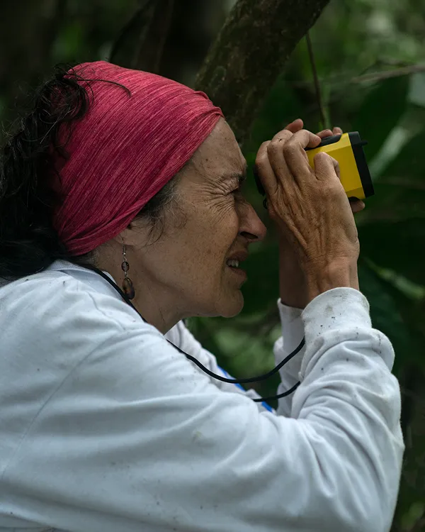
Through active monitoring — such as field trips and camera traps in strategic areas — we evaluate the presence of wildlife and identify areas of ecological connectivity. Thus, we ensure that the restoration not only captures water and carbon, but also recovers the functionality of the ecosystem.
Building Local Capacities
The workshops and training are focused on providing new knowledge to promote a better relationship with nature and to be able to publicize the importance of the actions carried out in each of the Toroto projects. We show how to carry out fieldwork following an internationally recognized methodology. In addition, there are trainings aimed at ensuring the safety of brigade members and workers.
(04)
The Impact
Conservation with co-benefits
.jpg)
Stewarding the Land for the Future
We conduct regular evaluations to strengthen ecological restoration efforts from the start of the project. This includes ensuring the survival of reforestation areas, effective maintenance of soil conservation works, preventive pest and fire control and, when applicable, monitoring the performance of productive projects.
Biodiversity Follows Water
Biodiversity doesn't just enrich the ecosystem: it gives it structure, supports the soil and allows water to infiltrate. Restoring native vegetation through reforestation and assisted regeneration improves habitat quality, stabilizes the landscape and creates shelters for key species.
Through active monitoring — such as field trips and camera traps in strategic areas — we evaluate the presence of wildlife and identify areas of ecological connectivity. Thus, we ensure that the restoration not only captures water and carbon, but also recovers the functionality of the ecosystem.
Building Local Capacities
The workshops and training are focused on providing new knowledge to promote a better relationship with nature and to be able to publicize the importance of the actions carried out in each of the Toroto projects. We show how to carry out fieldwork following an internationally recognized methodology. In addition, there are trainings aimed at ensuring the safety of brigade members and workers.
Regenerating nature, one project at a time
We do important things differently.